Master's Scholarly Product (2020)
Not loading? Click hereDownload zip file [5.2 MB]
My work, "Estimating Commercial and Residential Food Waste Generation at County Scale," is the first paper to model food waste generation at the county level for the entire United States. To use the data product, click the download link above; I recommend reading the paper first to gain a better understanding. Please note the readme.txt file, and please attribute proper credit with use. If you are working with this data, I'd love to hear about it via email!
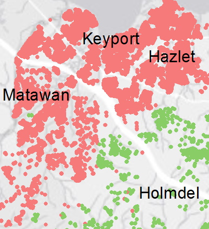
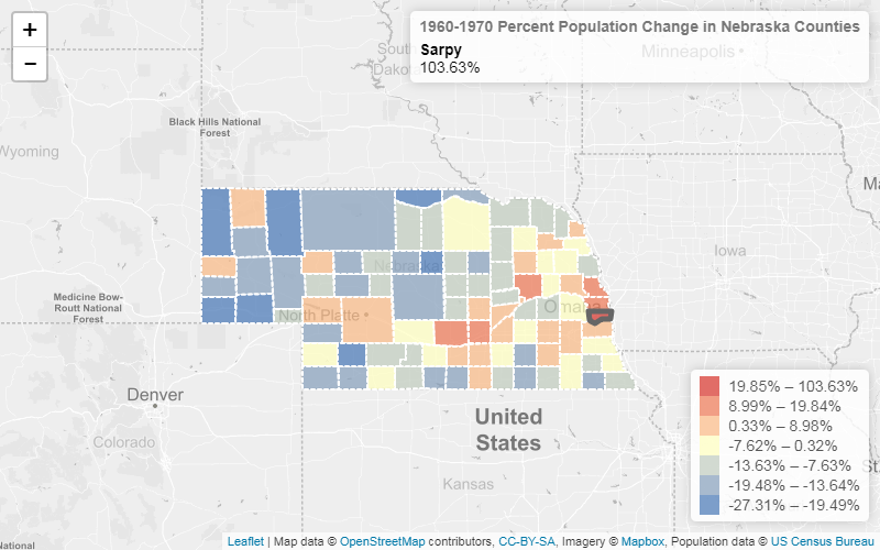
Graduate level Python course final (2019)
Not loading? Click hereMy final project for an advanced spatial data science Python course (GEOG788P) highlighted data visualization and spatial statistics capabilities of the pandas, geopandas, cenpy, pysal, plotly, and folium modules. For more, see the project's GitHub repository.
R course assignment (2019)
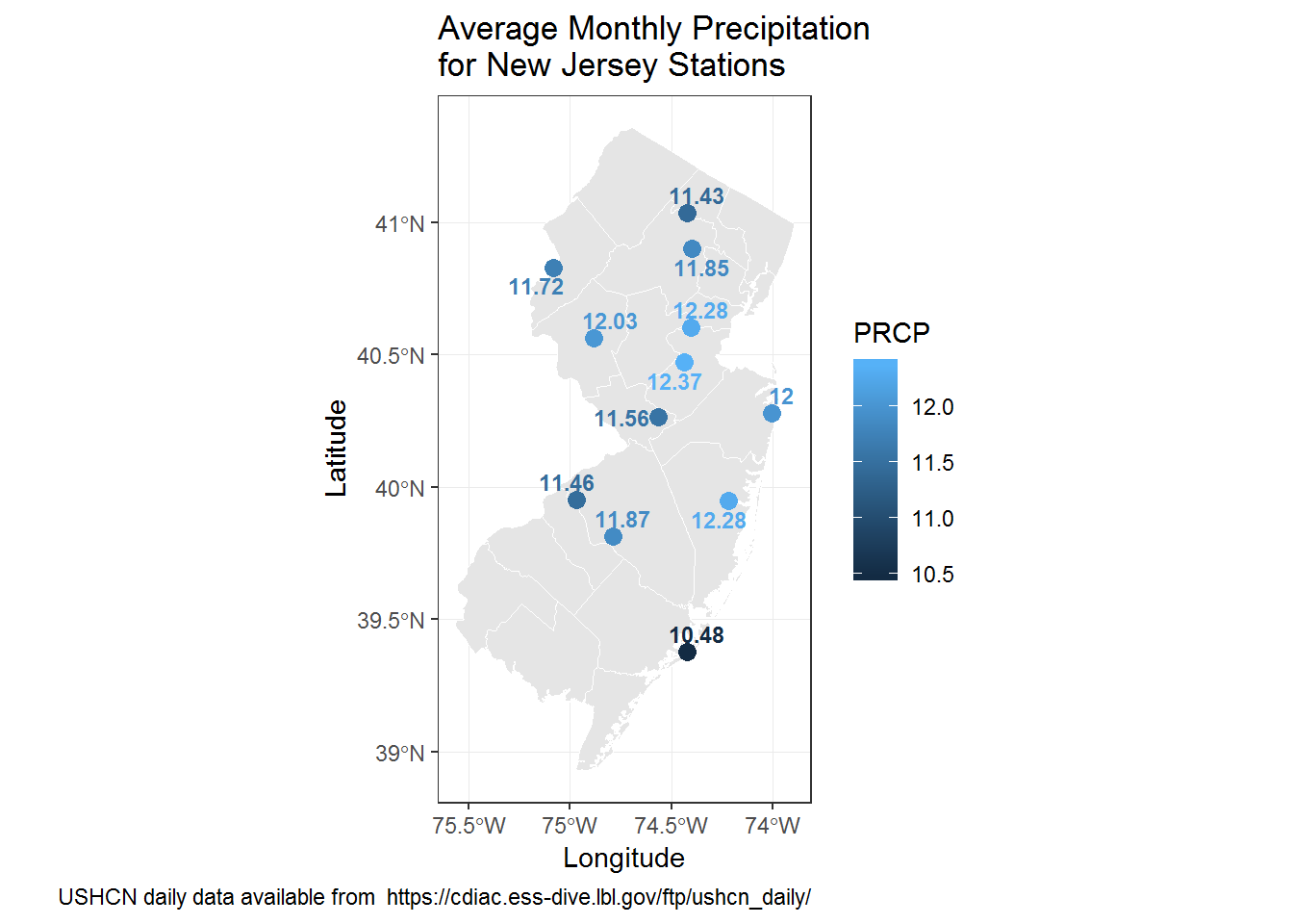
A map created with ggplot in R. This work is from the graduate level course GEOG606, Quantitative Spatial Analysis, where I learned multivariate statistical methods and R coding to solve spatial problems.
GEOG473 maps (2019)
Click on an image below for a larger version:
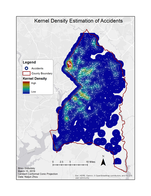
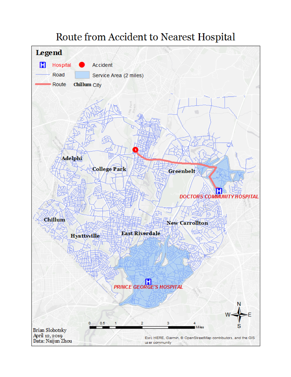
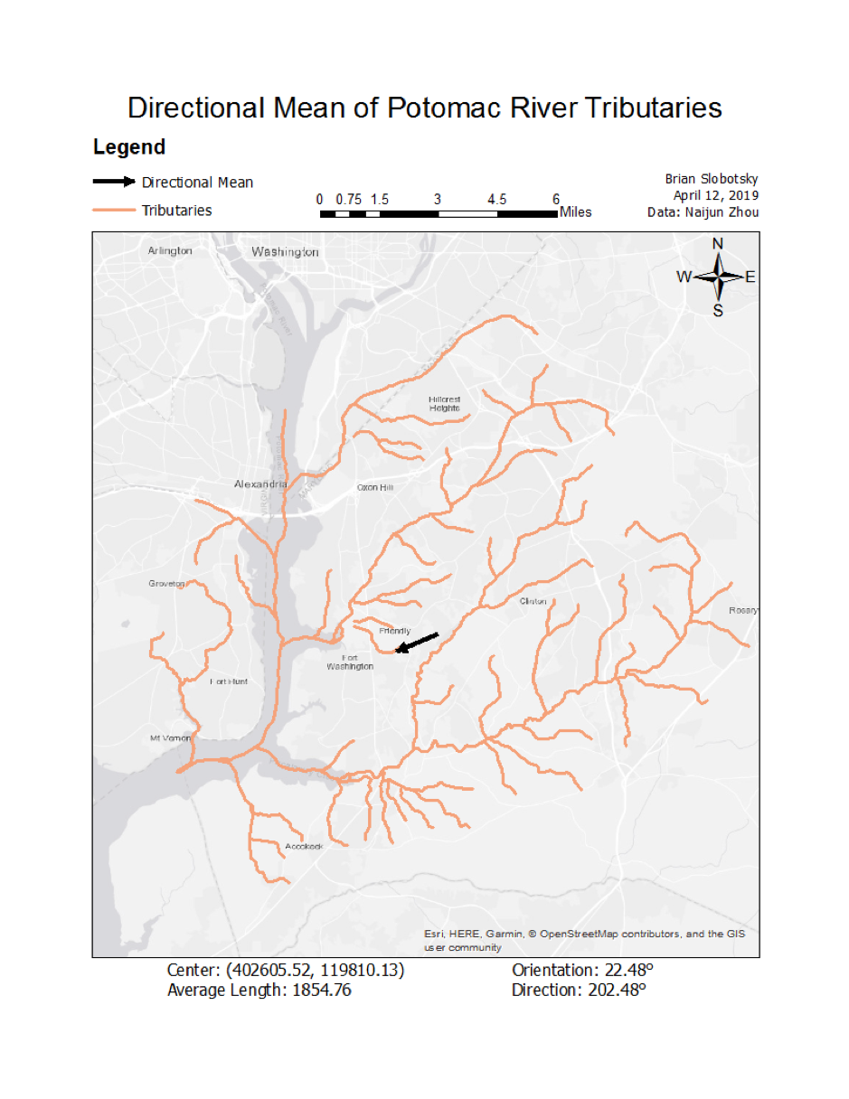
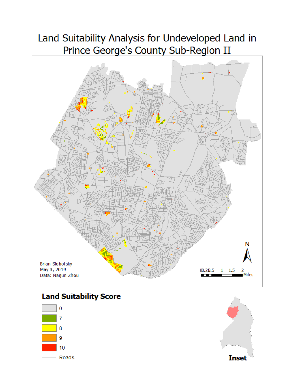
A few thematic maps from GEOG473, Geographic Information Systems and Spatial Analysis, a course designed to provide students practical experience with various aspects of GIS professional work. Each map above highlights a different scenario that a GIS analyst might encounter, such as routing an accident to the nearest hospital using Network Analyst (second image) and a site suitability analysis (fourth image).
Leaflet assignment for a cartography course (2018)
Assignment for GEOG475, Computer Cartography. This screenshot is all I can share because the HTML code was unfortunately saved in a location that I can no longer access. The course focused on understanding standard cartographic practices, creating effective thematic maps, and experimenting with interactive, animated, three-dimensional displays. It was one of my favorite courses!
Explore more:

Work project portfolio